Comprehensive tools for every stage of wind development
Identify the best wind sites with high-resolution data
Access high-resolution wind maps, long-term climate data and validated resource models to identify and assess the strongest wind energy locations before committing to site development.
Optimize wind farm design for maximum energy yield
With our industry-leading modeling and wake analysis tools, you can design layouts that minimize losses and maximize profitability to enable your project to reach its full potential.
Improve performance and efficiency of active wind farms
Monitor, analyze and optimize operational wind farms with real-time performance insights, predictive maintenance tools and advanced energy forecasting to help you increase uptime and efficiency.
Fast and accurate wind data analysis for greenfield site prospecting
The intuitive interface and easy workflow of ULTRUS™ Renewable Resource Assessment Platform (RRAP) Project Prospecting can help reduce the time and complexity of early-stage wind assessments.
Quickly identify viable wind project locations
Evaluate wind potential using 200-meter wind maps, statistical analysis and real-world energy yield models. RRAP enables you to compare multiple locations side by side, helping you identify the best sites for development.
Streamline energy yield assessments in minutes
Generate preliminary energy assessments in minutes, saving up to 10 hours to 50 hours per project. Integrate global reanalysis data, virtual met mast modeling and measure-correlate-predict (MCP) analysis for fast and reliable energy estimates.
Customizable, scalable analysis for any project
Define project areas, import turbine layouts and modify wind resource grids to match real-world development scenarios. Easily export energy yield results in multiple formats, enhancing compatibility with Geographic Information System (GIS) tools, financial models and engineering reports.
Wind farm design and layout optimization
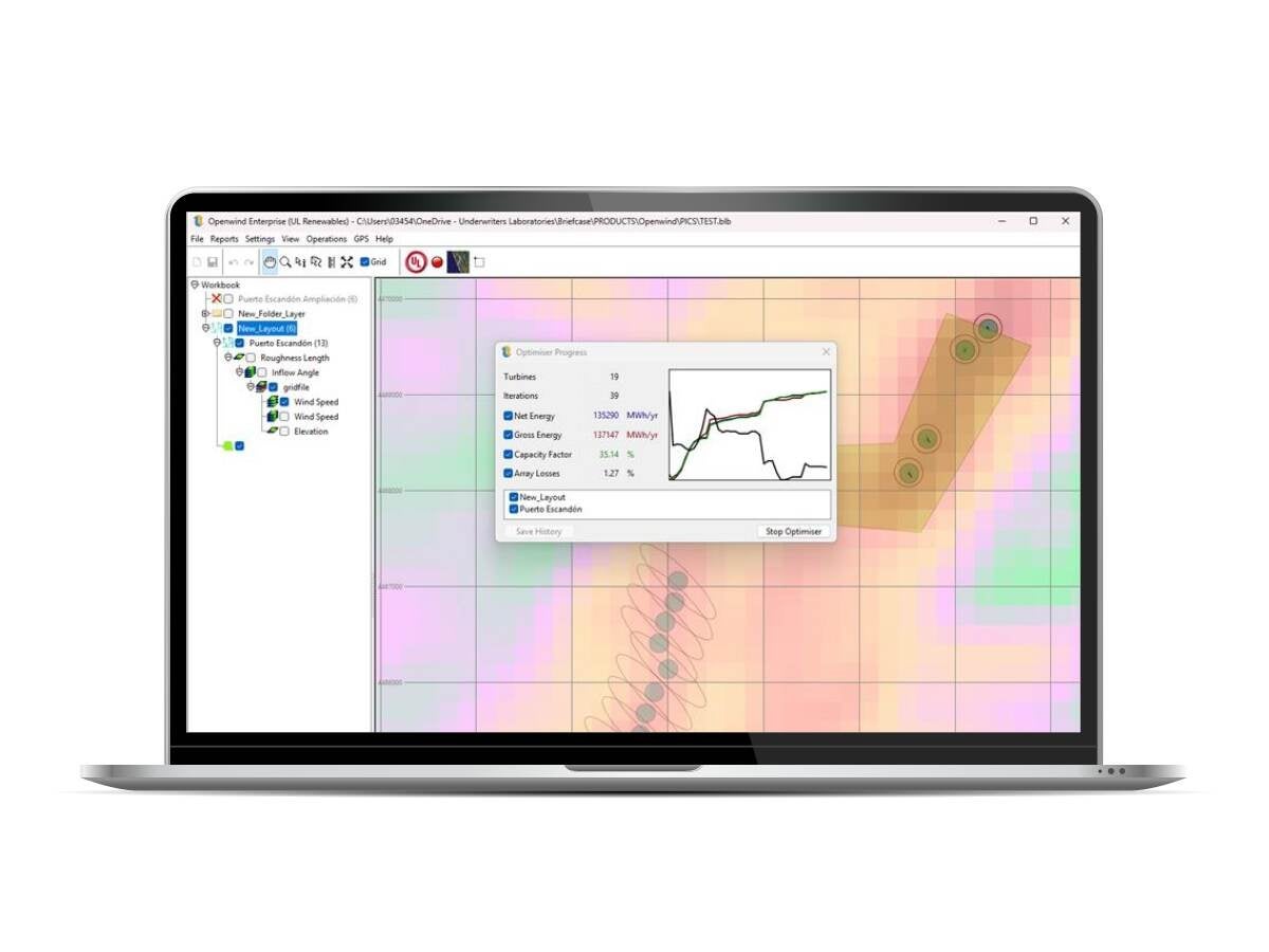
Maximize energy production and reduce inefficiencies with advanced site planning and wake analysis tools with Openwind wind farm design software.
Design smarter wind farms for maximum efficiency
Create layouts that maximize production while minimizing the levelized cost of energy (LCOE) with powerful turbine layout and optimization tools that account for wind resources, wake losses, curtailments, noise and environmental constraints.
Optimize turbine placement with real-world cost factors
Factor in access road costs, collector systems, terrain complexity and substation locations to design layouts that balance performance with project costs.
Minimize energy losses with advanced wake modeling
Simulating real-world interactions between turbines can help you reduce wake turbulence and improve energy yield. Fine-tune turbine spacing and alignment with deep-array wake models (DAWM) and multiple wake loss models.
Industry-leading wind resource data and maps
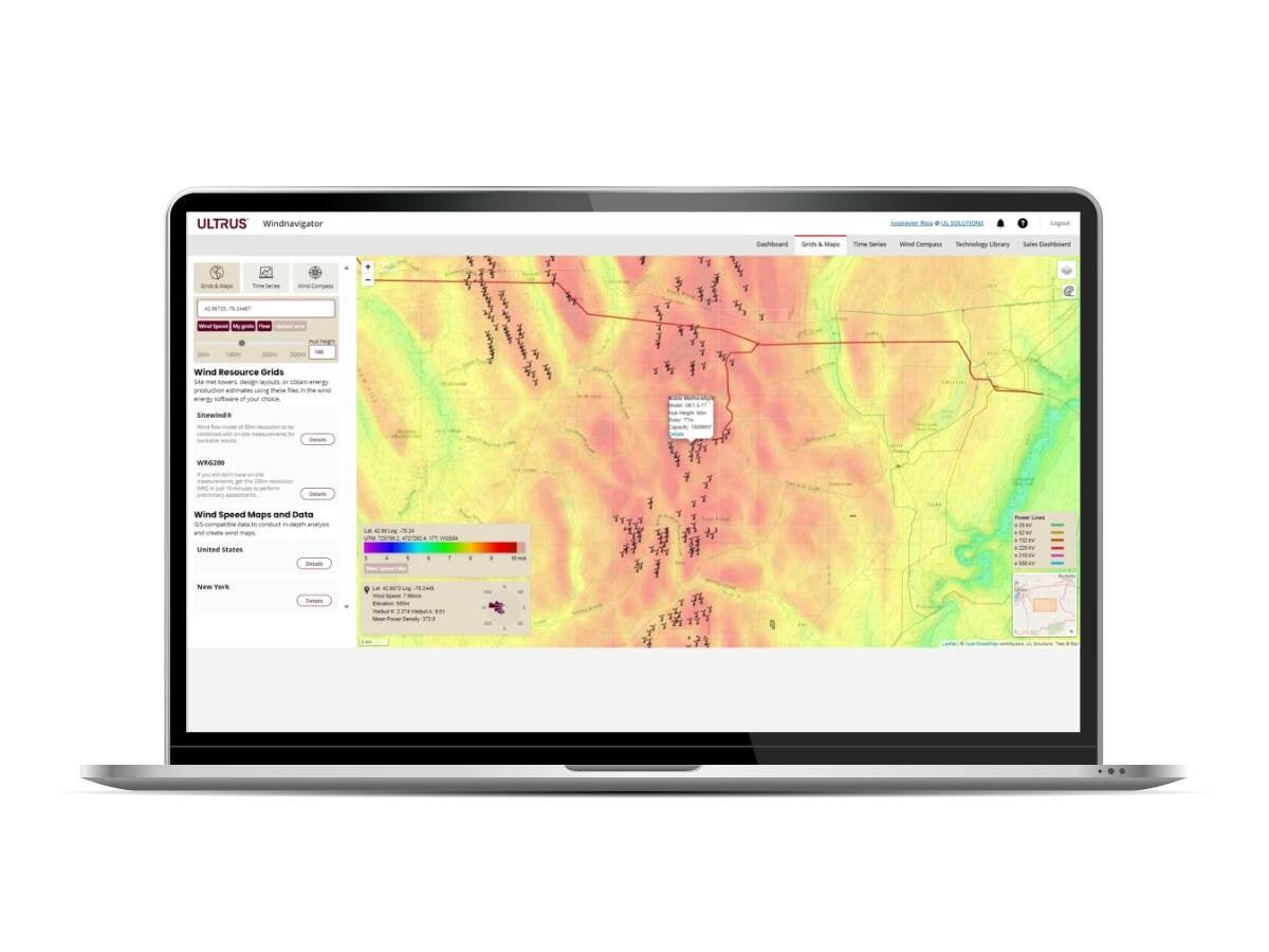
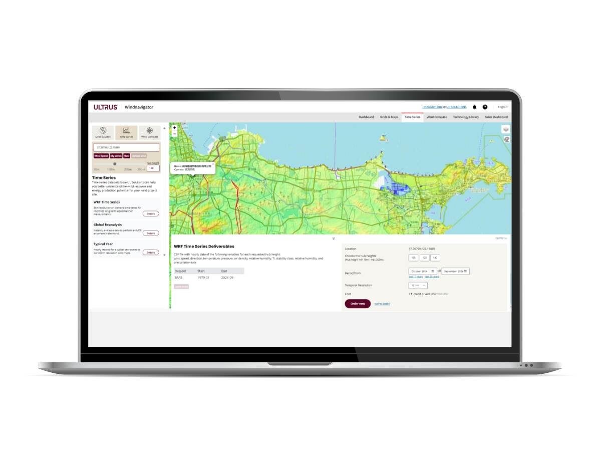
Know your wind resource before you invest. The ULTRUS™ Windnavigator platform provides high-resolution wind maps, historical climate data and GIS-ready datasets to help you identify and validate high-potential wind sites faster.
Visualize and compare sites with high-resolution wind maps
Access 200-meter resolution wind resource grids, digital elevation models and roughness data to understand site conditions before installing met towers.
Leverage long-term climate data for accurate forecasting
Analyze decades of reanalysis datasets, including M ERRA-2, ERA5 and WRF-based models, to validate wind speeds, turbulence and seasonal variations.
Seamless GIS integration for smarter decision making
Download wind maps in GeoTIFF, shapefile and KMZ formats to overall wind resource data with land ownership, grid access and environmental constraints.
Your steps to smarter wind development
Identify and assess high-potential wind sites
Use ULTRUS™ Windnavigator to access 200-meter resolution wind maps and GIS-ready datasets to pinpoint optimal locations based on wind resource availability, terrain and infrastructure constraints.
Evaluate site viability and energy potential
With RRAP Project Prospecting, compare multiple sites, analyze wind speed trends, turbulence intensity and long-term energy yield estimates, and determine project feasibility.
Optimize wind resource data for accuracy
Integrate on-site met tower or lidar measurements and refine long-term wind predictions using MCP analysis for more reliable energy estimates.
Design and simulate wind farm performance
Use Openwind to help you optimize turbine layouts, minimize wake losses and evaluate energy output with cost-based optimization models for smarter investment planning.
Monitor and maximize wind farm efficiency
Track operational performance, compare predicted vs. actual energy output and apply predictive maintenance models to help you reduce downtime and improve efficiency.
Frequently asked questions
- What is the Wind Developer Suite?
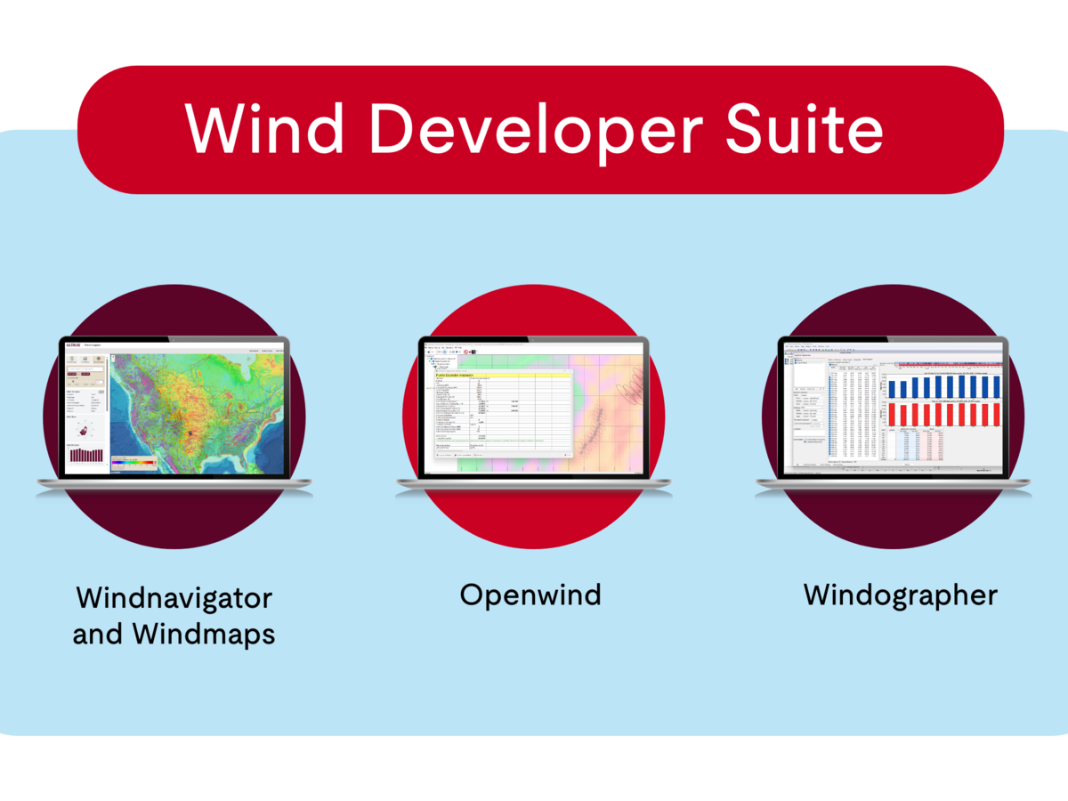
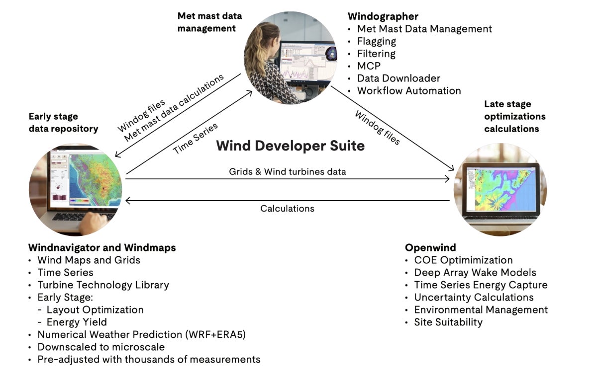
Our Wind Developer Suite is a comprehensive suite of tools designed for wind energy developers, engineers and asset managers. It covers the entire wind project life cycle, including site prospecting, wind resource assessment, wind farm design and operational performance monitoring.
- How does the Wind Developer Suite help wind developers?
By integrating high-resolution wind resource data, advanced modeling software and energy yield forecasting tools, the Wind Developer Suite can help developers reduce uncertainty, optimize wind farm layouts and improve operational efficiency — all within a streamlined workflow.
- What export formats are available for reports and analysis?
Reports and datasets can be exported in CSV, XLS, PDF, JSON, TXT, BLB and KML for compatibility with industry-standard tools for GIS analysis, financial modeling and investor reporting.
- Does the Wind Developer Suite support offshore wind development?
Yes, the Wind Developer Suite provides offshore wind resource assessment, wake modeling and site design tools that can help developers optimize offshore wind farm layouts, cable routing and maintenance planning.
Get connected with our sales team
Thanks for your interest in our products and services. Let's collect some information so we can connect you with the right person.
