


.jpg?width=150)
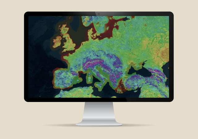
2025 Europe Wind Map
1.6 MB
Download this white paper to discover how our advanced modeling system powers the 2025 Europe Wind Map with sharper accuracy and deeper insights — now available in ULTRUS™ Windnavigator software.
Designed for wind developers driving the future of energy, the 2025 Europe Wind Map is built on our proprietary wind flow modeling system, blending state-of-the-art mesoscale and microscale techniques. Our map doesn’t just show wind patterns broadly; it captures subtle variations at a very fine scale. This layered approach provides more granular, higher-resolution wind speed data at 200 meters — helping project teams translate complex wind behavior into smarter strategies for site selection, design and long-term reliability.
We calibrate this map using real-world measurements from numerous met masts and remote sensing devices across Europe, instrumented for wind resource assessment. The data always reflects actual conditions on the ground — not just theoretical simulations — giving you more precision to plan with confidence.
The new release replaces the original map from 15 years ago and is now available through our ULTRUS™ Windnavigator Resource Data and Maps software. Developers can also leverage a significantly expanded dataset to help strengthen project planning and support the accuracy of wind resource evaluations.
Download our 2025 Europe Wind Map Methods and Validation white paper to explore the science behind this major update.
2025 Europe Wind Map